


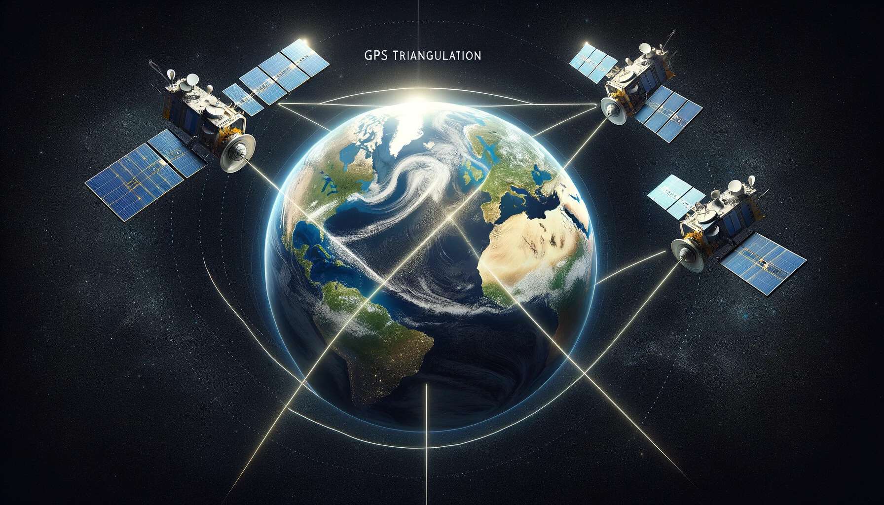
From Satellites To Your Smart Phone – How GPS Works
Have you ever wondered how GPS works to pinpoint your exact location? Imagine a constellation of satellites circling the Earth. These satellites communicate with your device, providing precise location data. GPS calculates your latitude, longitude, and even altitude. At its core, GPS relies on satellite signals and complex algorithms. Every time you use your phone’s map or a GPS device, this system is at work. It’s not just for maps, though; countless applications use GPS daily. From hiking to aviation, the applications are vast. In this step-by-step guide, we will go over everything you need to know about how GPS works so you have a firm grasp of the fundamentals of how the technology works. Let’s start with the 3 main components of GPS: satellites, ground stations, and GPS receivers.
Satellites
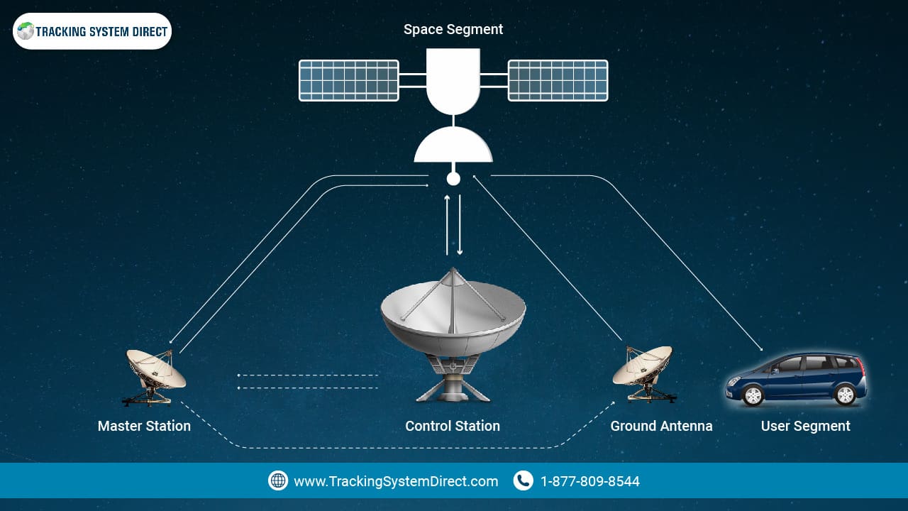
GPS, standing for Global Positioning System, owes much of its capability to a sophisticated array of satellites. These satellites, integral to the satellite navigation system, orbit our planet and serve as the primary beacons for positioning.
Each GPS satellite is a master of timekeeping, equipped with a precision atomic clock. These clocks maintain accurate timing, a cornerstone for how GPS functions. When satellites transmit their signals, it’s this precise timing that helps in determining the distance between the satellite and the GPS receiver. By evaluating signals from multiple satellites, GPS receivers can pinpoint a location. In essence, the better the timing, the more accurate the location.
The importance of satellites in the GPS equation cannot be understated. They form one of the three critical components of the system, with ground stations and user equipment completing the trio. Next, you’ll see how ground stations play an equally pivotal role in ensuring that GPS remains a reliable tool for navigation.
Key Takeaways:
- Satellites are foundational to the satellite navigation system of GPS.
- Every GPS satellite houses an atomic clock for accurate timing.
- This precise timing helps calculate distances and, subsequently, locations.
- Satellites are one of the three primary components of GPS, setting the stage for ground stations.
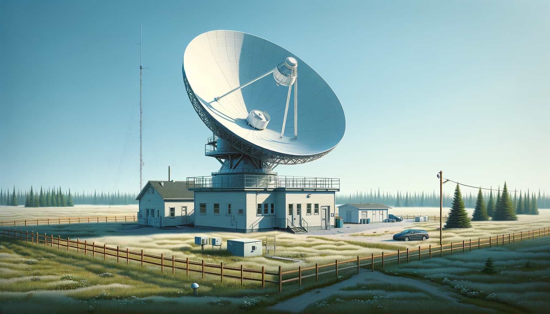
Ground Stations
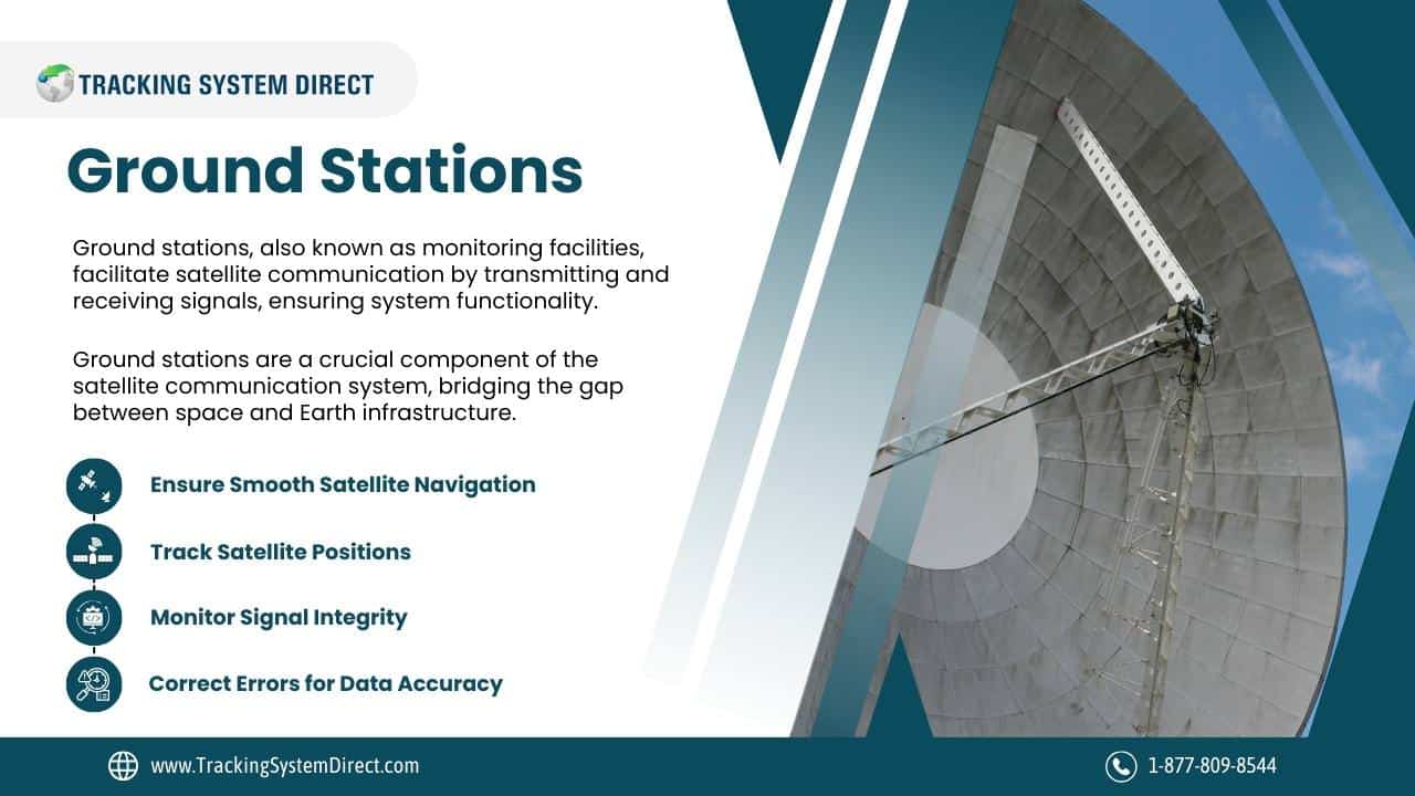
Commonly known as monitoring stations, ground stations are facilities equipped with antennas and communication equipment to transmit and receive signals from satellites. In fact, it’s the ground stations that provide vital support from the Earth’s surface, ensuring the smooth functioning of the entire satellite navigation system.
Each ground station continuously tracks multiple satellites, verifying their exact positions and monitoring the integrity of their signals. This constant surveillance ensures that the data transmitted by the satellites is both accurate and reliable. If any discrepancies or errors are detected, ground stations can send correctional data to the satellites, improving the accuracy of the system.
Ground stations play a pivotal role in the three-part equation of GPS, standing alongside satellites and user equipment. Their role emphasizes the balance between the vast expanse of space and the grounded infrastructure on Earth. Next, we’ll look at the third component, user equipment, to understand how all these pieces fit together seamlessly.
Key Takeaways:
- Ground stations monitor and verify the satellite signals from Earth’s surface.
- They play a crucial role in maintaining the reliability and accuracy of the GPS system.
- If errors are detected, ground stations can send corrective data to satellites.
- They are one of the three vital components of the GPS system, complementing satellites and user equipment.
GPS Receivers
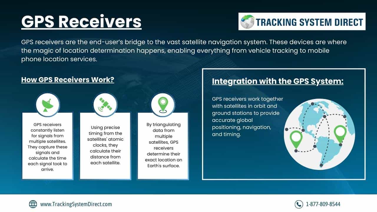
GPS receivers are the end-user’s bridge to the vast satellite navigation system. These devices are where the magic of location determination happens, enabling everything from vehicle tracking to mobile phone location services.
Every GPS receiver works by constantly listening for signals from multiple satellites. Once it captures these signals, the device calculates the time each signal took to arrive. Given the precise timing maintained by the satellites’ atomic clocks, this allows the receiver to calculate its distance from each satellite. By triangulating data from multiple satellites, the receiver can determine its exact location on Earth’s surface.
The GPS receiver is the final, essential piece in the three-part puzzle of the GPS system. It seamlessly integrates with the continuous support from satellites in orbit and the vigilant monitoring of ground stations. Together, these components offer an unmatched tool for accurate global positioning, navigation, and timing.
Key Takeaways:
- GPS receivers are devices that process satellite signals to determine location.
- They calculate the distance by evaluating the time taken for signals to arrive.
- Receivers triangulate data from multiple satellites to pinpoint exact locations.
- Completing the GPS trio, they work in harmony with satellites and ground stations for precise positioning.
SATELLITES | GROUND STATIONS | GPS RECEIVERS |
 |  |  |
How GPS Determines Your Position In 3 Simple Steps
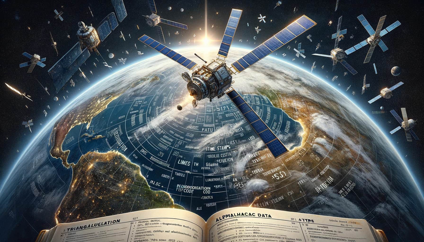
![]() Now that you understand the core components of the Global Positioning System – satellites, ground stations, and GPS receivers – it’s time to learn how GPS can determine your exact position. While these 3 elements form the backbone of the GPS system, the true essence of GPS positioning lies in the art of triangulation, the precision of time stamps, and the meticulous corrections ensuring unmatched accuracy. Through the synchrony of signals traveling at the speed of light, to the keen oversight of ground stations, this section will illuminate the science and precision behind how GPS pinpoints your location. Now, let’s take a closer look at the mechanics of how GPS truly determines your position starting with a process called triangulation.
Now that you understand the core components of the Global Positioning System – satellites, ground stations, and GPS receivers – it’s time to learn how GPS can determine your exact position. While these 3 elements form the backbone of the GPS system, the true essence of GPS positioning lies in the art of triangulation, the precision of time stamps, and the meticulous corrections ensuring unmatched accuracy. Through the synchrony of signals traveling at the speed of light, to the keen oversight of ground stations, this section will illuminate the science and precision behind how GPS pinpoints your location. Now, let’s take a closer look at the mechanics of how GPS truly determines your position starting with a process called triangulation.
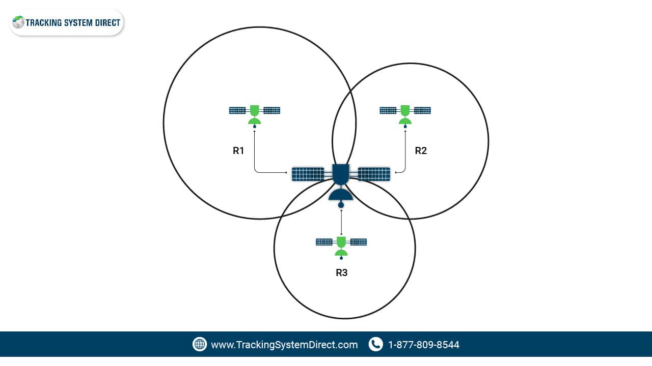
Triangulation
Triangulation is the backbone of how GPS determines your position on Earth. Think of it as a process where your location is pinpointed by measuring distances from several reference points. In the context of satellite navigation, these reference points are the GPS satellites orbiting our planet.
When your GPS device seeks to find its location, it listens for signals from these satellites. The time each signal takes to reach the GPS receiver, traveling at the speed of light, gives away the distance from each satellite. By calculating distances from at least four satellites, your device can figure out not just your latitude and longitude but also your altitude.
Why four satellites, you ask? Beyond just positioning on the earth’s surface, the fourth signal helps account for any timing discrepancies, given the reliance on precision timing from satellite atomic clocks.
Triangulation is vital for the global positioning system because it ensures you get accurate data about your location, whether you’re using GPS for vehicle tracking, navigation, or any other application.
- Triangulation pinpoints your location using distances from several GPS satellites.
- Signals from satellites travel at the speed of light, aiding in distance calculation.
- A minimum of four satellite signals ensures accurate latitude, longitude, and altitude readings.
- The global positioning system heavily relies on triangulation for precise user location.
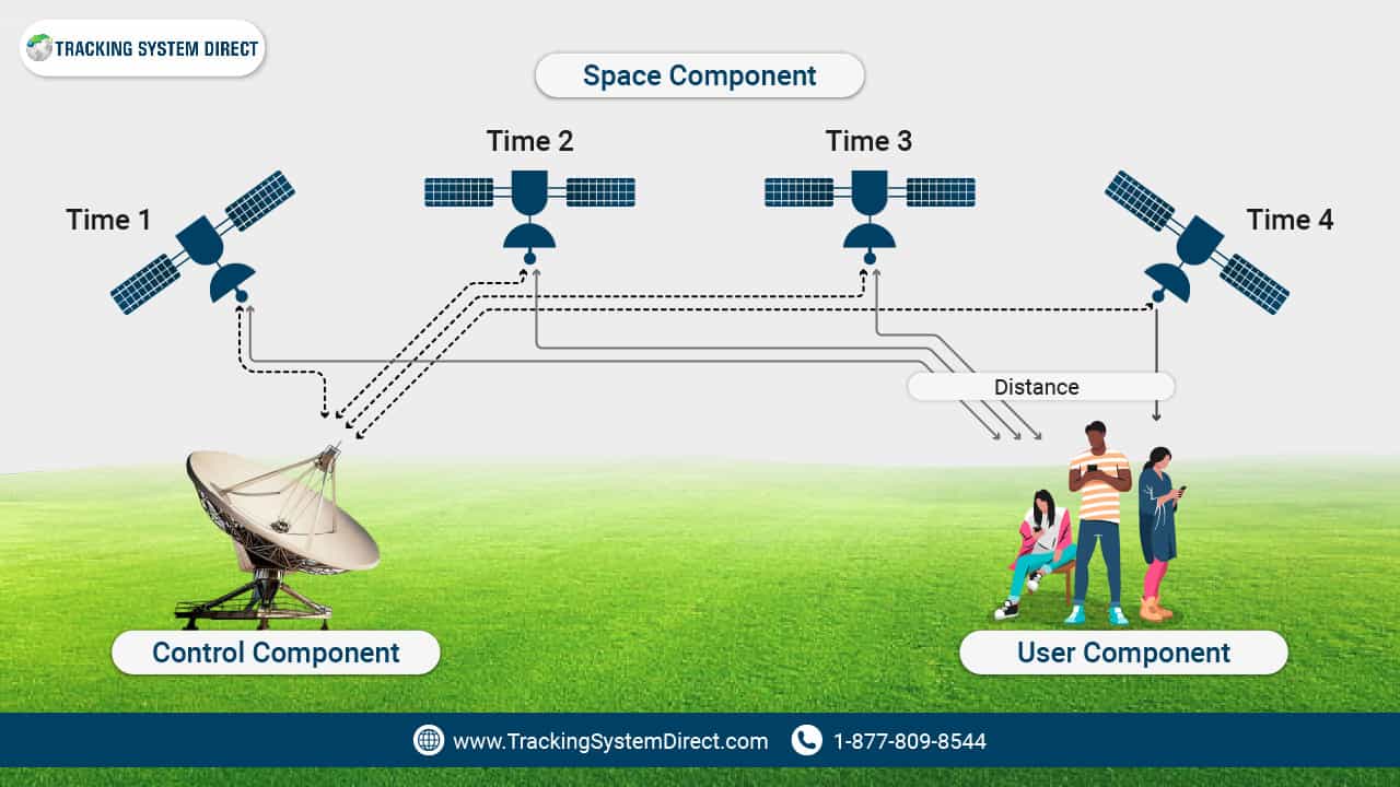
Time Stamps & Signal Travel Time
Time stamps and signal travel time play a pivotal role in the functioning of GPS. Every signal sent by a GPS satellite comes with a timestamp, marking its exact departure time. Upon reaching your GPS device, this signal’s arrival time is meticulously recorded.
The real work begins when the GPS calculates the difference between the signal’s transmission and its reception time. These signals travel at the speed of light, so their journey is swift. However, even a minor difference in time, as brief as a few milliseconds, can significantly alter the calculated distance from the satellite.
Understanding this timing and speed is crucial. It ensures that the GPS can determine your exact position, whether you’re navigating urban landscapes or trekking in remote areas.
- Every satellite signal carries its own timestamp, marking its departure.
- The GPS device records the precise moment it receives the signal.
- Using the time difference and the speed of light, the GPS calculates the distance from the satellite.
- This methodology provides accurate location data through the global positioning system.
Corrections & Accuracy

Corrections and Accuracy are essential facets of the GPS system, ensuring the data you receive is both precise and dependable. Ground stations, strategically positioned around the globe, play a key role in this refinement process.
These stations continuously monitor the signals transmitted by GPS satellites. They identify any deviations, which could be caused by atmospheric disturbances, imperfections in satellite clocks, or other external factors. Once identified, corrective data is relayed back to the satellite or directly to GPS receivers to rectify these inaccuracies.
This continuous monitoring and correction process is imperative. It guarantees that despite potential interference or errors, the location data provided to users remains accurate and trustworthy.
- Ground stations continuously track and verify GPS satellite signals.
- They identify and correct errors due to atmospheric factors or satellite clock issues.
- Corrective data is sent to ensure accurate and reliable location information.
- This correction mechanism is vital for the integrity of the global positioning system.
GPS Satellite Functionality – Understanding Ephemeris and Almanac Data Functions
Have you ever wondered how GPS satellites function? Every GPS satellite emits a distinct signal, which your GPS receiver decodes. This enables it to determine the satellite’s precise location. Given that these signals travel at light speed, your receiver uses this consistent speed in its calculations to pinpoint its position on Earth.
So, how does your device translate this satellite data into a location? It employs a method called “Trilateration“. This involves measuring the time taken for the signal from each satellite to reach the receiver. To get a 2D position and movement details, your device needs signals from at least three satellites. For a comprehensive 3D position, it requires four or more. On an average day, depending on where you are and the time, your GPS receiver might track signals from eight or even more satellites.
For the math enthusiasts, here’s a tidbit: to finalize its calculations, your GPS receiver requires the correct positioning data from a minimum of four satellites. It then calculates vital metrics like:
- Earth’s latitude
- Earth’s longitude
- Elevation
- Time
With these parameters, your GPS device can determine additional metrics by considering your subsequent position, time, and distance. These might include your trip distance, speed, bearing, track, and even times for sunrise and sunset.
Transmitted Signals From GPS Satellites
GPS satellites emit at least two low-power radio signals, each packed with vital data:
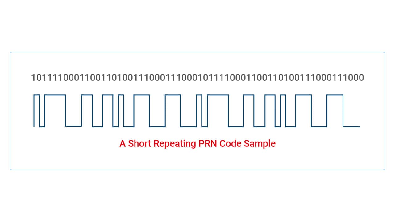
Pseudorandom Code
The Pseudorandom Code is a predefined sequence of 1s and 0s transmitted by each GPS satellite. Although its name suggests randomness, the sequence is deterministic and follows a specific pattern known in advance. This code’s complexity and unique nature for each satellite are essential for multiple reasons:
- Signal Identification. Every GPS satellite transmits its distinct Pseudorandom Code, allowing GPS receivers to uniquely identify and isolate signals from individual satellites. This differentiation is critical in environments saturated with numerous signals.
- Rapid Lock-On. The distinct pattern of the Pseudorandom Code aids GPS receivers in quickly locking onto a satellite’s signal, establishing a connection, and starting the data extraction process.
- Accuracy in Positioning. The Pseudorandom Code ensures that receivers can accurately measure the time delay between when the signal was sent by the satellite and when it was received. This time measurement is foundational in calculating the distance between the satellite and the receiver, which is essential for precise positioning.
In summary, the Pseudorandom Code is an integral component of the GPS system, ensuring that signals are uniquely identifiable and that accurate distance measurements can be made for precise positioning. Without the Pseudorandom Code, the functionality and reliability of the GPS system would be compromised.
TLDR: This unique code for each satellite is a sequence of 1s and 0s, so intricate that it often seems like random electronic noise. This complexity gives it the name “pseudo-random.”
Ephemeris Data
Ephemeris Data is a critical set of information broadcasted by each GPS satellite. This data is not static; rather, it’s updated regularly to ensure its accuracy and relevance. Here’s a breakdown of its essential elements and their significance:
- Current Time: Every GPS satellite is equipped with an atomic clock, providing highly accurate time data. This timestamp is vital for the GPS receiver to determine the time taken for the satellite’s signal to reach it, a crucial factor in distance measurement and location pinpointing.
- Satellite’s Location: The ephemeris data provides the precise orbital location of the satellite at any given moment. This is vital as the GPS receiver uses this information, along with the time stamp, to calculate its distance from the satellite.
- Satellite Health Status: This refers to the operational status of the satellite. It informs the GPS receiver about the reliability and integrity of the data being transmitted. If a satellite has issues, its data can be disregarded by the receiver to ensure accurate positioning.
The significance of Ephemeris Data in the GPS system:
Position Calculation: By having accurate time and location data from multiple satellites, the GPS receiver can compute its exact position on Earth’s surface using trilateration.
Data Integrity: Knowing the health status of satellites allows the GPS receiver to make informed decisions about which signals to rely on. By ignoring potentially faulty satellites, the system maintains its accuracy.
Enhanced Speed & Efficiency: With precise and up-to-date ephemeris data, GPS receivers can quickly lock onto satellite signals and determine location, making the positioning process faster and more efficient.
Ephemeris Data is fundamental to the GPS system’s operation, offering the crucial information needed to ensure quick, accurate, and reliable positioning. Without this data, the accuracy and efficiency of GPS would be significantly reduced.
TLDR: This data encompasses the current time, the satellite’s location, and its health status. With it, the GPS receiver gauges its position relative to other satellites.
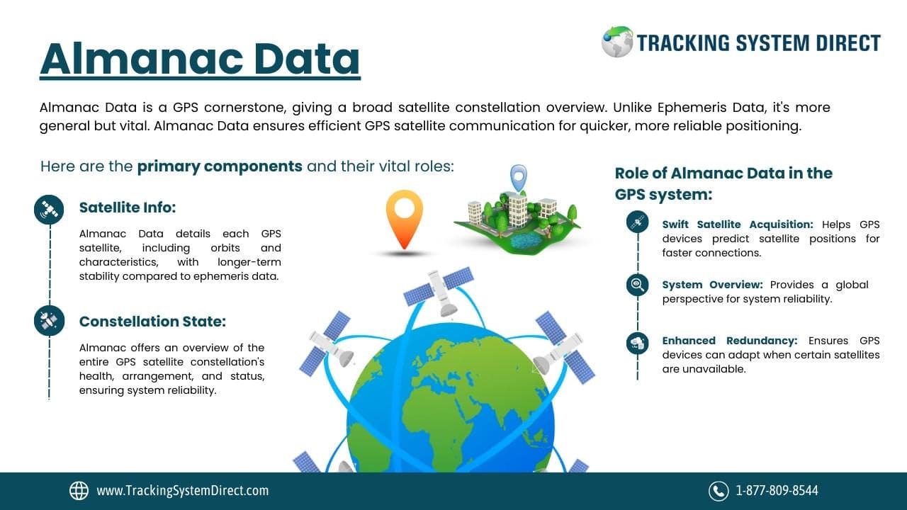
Almanac Data
Almanac Data stands as a cornerstone of the GPS system, offering a broad overview of the entire satellite constellation. Unlike the specific, regularly-updated Ephemeris Data, Almanac Data provides more general information but remains indispensable. Here are the primary components and their vital roles:
- Satellite Information: The Almanac Data offers details about each satellite in the GPS constellation, including its orbital parameters and unique characteristics. This data doesn’t change as frequently as ephemeris data, providing a longer-term perspective on the satellite network.
- Constellation State: Beyond individual satellite details, the Almanac gives a snapshot of the overall health, arrangement, and operational status of the entire GPS satellite constellation. This broad view ensures the system’s resilience and reliability.
The critical role of Almanac Data in the GPS system:
Swift Satellite Acquisition. Equipped with Almanac Data, a GPS receiver can predict which satellites should be in its line of sight at any given moment. This predictive capability allows the receiver to quickly locate and lock onto these satellites, accelerating the time-to-first-fix (TTFF).
System Overview. The Almanac provides a global perspective on the entire GPS satellite constellation, ensuring that the GPS receiver has a holistic understanding of the network it’s interfacing with. This information is essential for optimal system performance and robustness against potential errors.
Enhanced Redundancy.By providing details on all satellites, the Almanac Data ensures that if a particular satellite or set of satellites is inaccessible, the GPS receiver can rapidly adjust its strategy and rely on other available satellites to determine its position.
In essence, Almanac Data is a comprehensive guidebook for the GPS system. It ensures that receivers have the broad information needed to interface with the satellite constellation effectively, making the positioning process more efficient and robust.
TLDR: Continuously transmitted by GPS satellites, this data contains details about each satellite and the overall state of the entire GPS satellite constellation. This valuable information helps your GPS device locate available satellites quickly and secure a faster “fix.”
An Overview Of The 5 Main Uses Of GPS Technologies
GPS isn’t just about pinpointing your location on a hiking trail or navigating city streets. Its reach is far more expansive and influential. From surveyors sketching out precise maps to first responders rushing to emergencies, GPS stands as an unwavering ally. Can you believe that even in adverse weather conditions, this tool offers reliable data? This isn’t just about location; it’s about timing, tracking, and so much more. Let’s look at why GPS is crucial across so many sectors and how its accurate data and improved accuracy shape our world.
At its core, GPS primarily caters to five significant needs:
- Location: Pinpointing a precise position, be it on land or sea.
- Navigation: Assisting in moving from point A to B, ensuring you’re on the right track.
- Tracking: Ever used tracking devices to monitor a package? That’s GPS at work, overseeing movement.
- Mapping: From city layouts to expansive terrains, GPS helps sketch our world’s blueprint.
- Timing: Synchronized clocks and precise timing measurements, all thanks to the intricate dance of satellites in space.
With a legacy that traces back to when the first satellite was launched, to the modern era of Navstar GPS and space-based positioning navigation, the journey and evolution of GPS are nothing short of remarkable. Next time you check traffic or use gps navigation, remember the vast network and technology backing your simple query.
GPS Use Cases: How Location-Based Technologies Are Utilized In The Real World
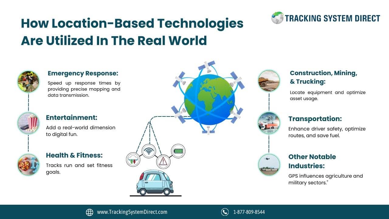
Emergency Response: When disasters strike, every second counts. GPS aids first responders by offering precise mapping and weather tracking, ensuring they reach those in need swiftly. Did you know in regions like the EU and Russia, vehicles use GLONASS technology to send vital data to emergency teams during accidents? This speeds up response times, potentially saving lives.
Entertainment: Ever wondered how games like Pokémon Go and Geocaching guide you to virtual treasures? It’s all thanks to GPS, adding a real-world dimension to digital fun.
Health and Fitness: Your smartwatch tracks your morning run, but how? GPS technology measures your distance, helping you compare your progress with others and set fitness goals. In fact, Dr. David Sinclair, A.O., P.h.d, says measuring this health data can be critical to your longevity!
Construction, Mining, and Trucking: GPS isn’t just about directions. In industries like construction, it’s essential to locate equipment and optimize asset usage. Imagine ensuring your machinery is always where it needs to be, boosting efficiency. Not to mention, secretly tracking work vehicles to make sure employees are going where they say they are going!
Transportation: Logistics firms rely on GPS for more than just routes. Through telematics systems, they enhance driver safety, optimize routes, and save fuel. Consider how a simple lorry tracker can streamline a whole fleet’s operations.
Other Notable Industries: The applications don’t stop there. From farming practices in agriculture to autonomous vehicle navigation and military operations, GPS has its mark everywhere. Whether securing mobile communications or tracking fishing boats, can you see just how intertwined GPS is in our daily lives?
A Brief History Of GPS: From Sputnik to Your Smartphone
The origins of the Global Positioning System, or GPS as you might know it, are deeply rooted in the space race era. Think back to the late 1950s, when the Soviet Union launched Sputnik into orbit. Scientists quickly realized they could track this satellite using shifts in its radio signals, known as the Doppler Effect. Fascinating, right?
Fast forward to the mid-1960s. The US Navy, inspired by the potential of satellite navigation, began experiments to locate submarines. Using only six satellites, they managed to find the exact submarine locations through changes in the Doppler of satellite signals. As the Cold War progressed, the US government recognized the pressing need for a robust global navigation system, leading to the birth of GPS primarily for military applications. By the 1970s, the Department of Defense combined previous naval research with its resources to launch ‘NAVSTAR’ in 1978, becoming fully operational by 1993.
While the initial GPS was a military tool, its potential for civilian use couldn’t be ignored. However, early civilian systems were sizeable and lacked precision. To deter adversaries from harnessing the system’s full potential, the US employed dithering, intentionally introducing errors. But by the 2000s, barriers lifted, giving the public unhindered GPS access, changing navigation forever.
GPS Timeline Of Key Events
- October 1957: Soviet Union launches Sputnik I, laying the groundwork for satellite-based navigation.
- Mid-1960s: US Navy conducts satellite navigation experiments to locate submarines.
- Early 1970s: The US Department of Defense (DoD) conceptualizes a comprehensive satellite navigation system.
- 1978: DoD launches the ‘NAVSTAR’ satellite system.
- 1993: NAVSTAR becomes fully operational.
- 1983: GPS becomes publicly available but with limited data access.
- 2000: Full public and corporate access to GPS is granted, propelling advancements in navigation technology.
Related Article: Who Invented GPS?
FAQs On How GPS Works
What Are The Uses Of GPS?
Primarily, the global positioning system helps in navigation and location tracking. You might use GPS for car navigation, hiking routes, or even flight paths. Beyond that, sectors like agriculture use GPS for precision farming, and businesses use it for fleet management and vehicle tracking.
Can GPS Know When There Is Traffic?
Yes, GPS can detect traffic. But how? Your GPS device combines its location data with real-time information from other users. If multiple GPS devices slow down in an area, traffic congestion is likely. Data from the Department of Transportation and other sources can also be integrated for a comprehensive traffic overview. Ever noticed how your route adjusts in real-time? That’s this feature at work!
What Is The Frequency Range Of GPS Signals?
GPS signals primarily operate on two distinct frequencies. The first is L1, which is set at 1575.42 MHz. The second is L2, clocking in at 1227.60 MHz. These frequencies are essential because they allow the GPS system to compensate for ionospheric signal delays, enhancing positioning accuracy. L1 carries both the civilian (C/A code) and the encrypted P-code, used primarily by the military. Civilian GPS devices predominantly utilize the L1 frequency due to its inclusion of the C/A code, which aids in a quicker and more reliable satellite lock. On the other hand, L2 has historically been geared more towards military applications, though advancements are allowing dual-frequency receivers to access both L1 and L2 for even better accuracy. As GPS technology continues to evolve, the utilization of these frequencies and the introduction of new ones, such as L5, aim to provide more precise and reliable positioning data across various applications.
Why Do GPS Devices Need Signals From At Least Four Satellites?
To calculate location, GPS devices need signals from at least four satellites. This helps determine latitude, longitude, and altitude, and correct any potential clock discrepancies in the gps receivers. The fourth satellite essentially acts as a check, ensuring positioning accuracy. Can you imagine the precision timing involved in this process?
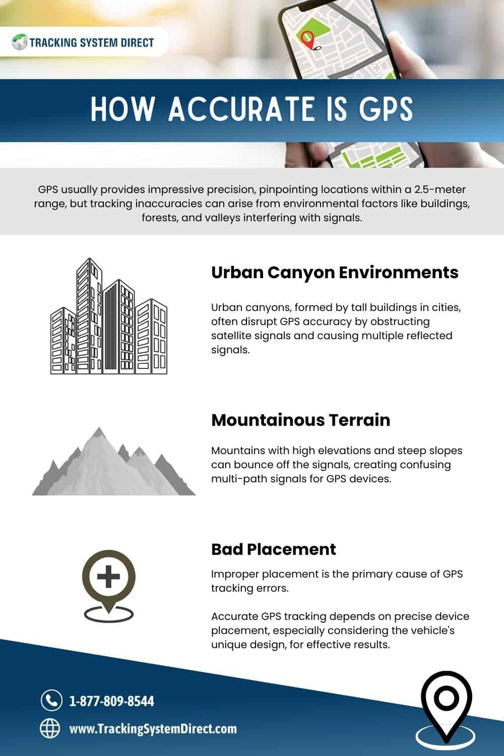
Does Atmospheric Interference Affect GPS Accuracy?
Yes, atmospheric conditions can affect GPS accuracy. Layers of the Earth’s atmosphere can slow down the speed of GPS signals. But, fear not! Ground stations and monitoring systems provide corrective data to address these inaccuracies, ensuring the signals you receive are precise. This continuous calibration is why your GPS device remains reliable even during weather changes.
Absolutely! While the United States Global Positioning System (GPS) is well-known, there are other global navigation satellite systems. Europe has Galileo, Russia uses GLONASS, and China operates BeiDou. Each has its own satellite constellations, but they all aim to provide accurate positioning navigation, and timing services.
Can Natural Obstacles Like Mountains Affect GPS Accuracy?
Yes. Mountains, dense forests, and tall buildings can block or deflect GPS signals. This interference may reduce accuracy. In cities, this phenomenon is called the “urban canyon” effect. Always ensure a clear line of sight to the sky for best results.
Do All GPS Devices Offer The Same Level Of Accuracy?
No, consumer-grade GPS devices can be off by several meters. For precise tasks, specialized systems exist. Military and survey-grade GPS systems provide centimeter-level accuracy. Always choose a device suited to your specific needs.
For more technical frequently asked questions on how GPS works, please click here.
How GPS Works – Glossary
- Triangulation: A process where your location is determined by measuring distances from several reference points, in this case, GPS satellites.
- Time Stamps: Marks of the exact departure time of a signal.
- Trilateration: A method that involves measuring the time taken for signals from multiple satellites to reach a receiver to determine its position.
- Pseudorandom Code: A predefined sequence of 1s and 0s transmitted by each GPS satellite, used for signal identification, rapid lock-on, and accurate distance measurement.
- Ephemeris Data: Critical information broadcasted by each GPS satellite, including current time, the satellite’s location, and its health status, used for position calculation and data integrity.
- Almanac Data: Broad information about the entire GPS satellite constellation, including satellite details and constellation state, used for swift satellite acquisition and predictive capabilities.
- Time-to-First-Fix (TTFF): The time it takes for a GPS receiver to determine its position after it’s initially turned on or started.
- Atomic Clock: A highly accurate clock that uses the vibrations of atoms to keep time, crucial for precise timing in GPS satellite signals.
Some images in this article, “How GPS Works” were generated using AI

- Best Car GPS Tracker - October 25, 2023
- How GPS Works - October 8, 2023
- Who Invented GPS - October 6, 2023
Contents
- From Satellites To Your Smart Phone – How GPS Works
- Satellites
- Ground Stations
- GPS Receivers
- How GPS Determines Your Position In 3 Simple Steps
- GPS Satellite Functionality – Understanding Ephemeris and Almanac Data Functions
- An Overview Of The 5 Main Uses Of GPS Technologies
- A Brief History Of GPS: From Sputnik to Your Smartphone
- FAQs On How GPS Works
- What Are The Uses Of GPS?
- Can GPS Know When There Is Traffic?
- What Is The Frequency Range Of GPS Signals?
- Why Do GPS Devices Need Signals From At Least Four Satellites?
- Does Atmospheric Interference Affect GPS Accuracy?
- Are There Other Satellite Navigation Systems Besides GPS?
- Can Natural Obstacles Like Mountains Affect GPS Accuracy?
- Do All GPS Devices Offer The Same Level Of Accuracy?
